 |
|

Trip Check
Click on the NW section of the Oregon map for a link to the
ODOT camera at
Hwy 101 and Logan Road in Lincoln City.
Cams, Roads & Weather
New weather site: This site apparently has the entire weather records for several cities across the nation -- even down to hourly observations, which are updated to the site moments after the observations are taken. It also has generic climate information for any date of the year -- great for wedding or outdoor planning. In beta testing - http://weatherspark.com/
| Lincoln City weather websites and webcams | |
| Inn at Spanish Head - Channel 2 (KATU) | spanishhead.com/site/katu.html |
| National Weather Center | http://forecast.weather.gov |
| Roads End - Surf Shop | lcsurfshop.com/webcam.htm |
| Siletz Bay - Johnny | jonnycam.com/webcam.htm |
| NOAA's Advanced
Hydrologic Prediction Service |
nws.noaa.gov/oh/ahps/ water.weather.gov/ahps |
| NOAA Weather | |
| River Flow, Tides and Weather | waterdata.usgs.gov/or/nwis/rt |
| Tide Predictions | saltwatertides.com |
| Surf Report | oregonsurfcheck.com |
| Weather Underground | wunderground.com |
| CNN weather | weather.cnn.com/weather/forecast |
| The Weather Station | weather.com |
| AccuWeather | accuweather.com |
| Weather for You - Grants Pass, OR site | weatherforyou.com |
| OSU Hatfield Marine Science Center-Newport | weather.hmsc.orst.edu/index.htm |
| West Devils Lake State Park Not really a cam, but photos to pan the lake |
oregonstateparks.org/park_216.php |
|
|
||||
Lincoln
City's weather is temperate. The weather changes from year to year and can
depend on variables such as El Nino. Pacific Ocean water currents also
play a part in the temperature. Weather extremes such as very high temperatures
or extremely low temperatures are not the norm in Lincoln City. Many
Lincoln City residents consider Lincoln City to be located in the banana
belt - just
south of Cascade Head and tucked away from the north coast. Temperatures
are usually warmer here than those of the north coast. Wind direction can
influence
temperature. Winds can sometimes be stronger in the summer. Often September
and October have the best weather with mild temperatures and less wind.
Weather
Center
Lincoln City has purchased land at the end of 51st St across from Mo's for
a weather center. The plan is to construct a facility that will provide accurate
weather data for the central Oregon coast as well as a family-oriented tourist
attraction. Lincoln City needs to provide accurate weather information to tourist
markets in the population centers of Oregon and beyond. The weather center
has backing from the Governor's Office of Community Solutions.
Oregon Coast Weather - Monthly Average
The temperatures in the chart below may be low for Lincoln City. Check
the weather websites for the best data.
| Weather averages |
Jan
- Mar
|
Apr
- June
|
July
- Sept
|
Oct
- Dec
|
| Temperature |
45
F
|
53
F
|
59
F
|
50
F
|
| Precipitation |
11.9"
|
3.6"
|
1.4"
|
10"
|
| Days of Rain |
19
|
13
|
7
|
17
|
| Wind Direction |
SW
|
W/NW
|
NW
|
NW/SW
|
Average wind speed
4-15 MPH (6-24 KmH) with summer gusts to 60 MPH (97 KmH) and 80 MPH (130
KmH) in the winter.
Weather at CNN - www.cnn.com/WEATHER/
| Tide information | |
| Hatfield Marine Science Center | hmsc.orst.edu/weather/tides/tides.html |
| National Oceanic & Atmospheric | co.ops.nos.noaa.gov/tides03/tpred2.html |
| Tides | saltwatertides.com |
Road
conditions
Accurate weather reports and road conditions are essential to Lincoln City's
economy. Highways 18 and 101 are the main arteries supplying Lincoln City.
Major storms can close roads. The public needs to have the correct information
about closures and openings of roads. Tourists often rely on Portland TV weather
reports to determine their travel activity. At one time there was a committee
to work on transportation issues, especially concerning Highway 18 in the winter.
Weather
wise - play it safe - use caution
A few tips to make living and visiting here safe
1. watch for sneaker waves on the beach
2. stay away from logs on the beach that can roll in the surf - avoid danger
that can kill
3. if you feel an earthquake head for high ground immediately and stay there,
a tsunami (gigantic wave) may be headed for the coast, the second wave can
be more destructive than the first. Watch for evacuation route signs. Public
access TV Charter Cable Channel 4 airs an educational video about tsunamis
that is well worth the time to view.
4. check road conditions for weather related hazards - high water on East Devils
Lake Road, downed trees and power lines from high wind, black ice in the morning
5. take a Red Cross Basic Survival Course
 |
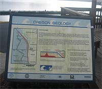 |
Earthquakes & Tsunamis
- download pdf map
Pick up a tsunami brochure at City Hall. An Earthquake Hazard Map for Lincoln
City by the Oregon Department of Geology and Mineral Industries (DOGAMI) should
be available on CD-ROM for purchase through Nature of the Northwest Information
Center, 800 NE Oregon St., #5, Portland, OR 97232, 503-872-2750 or www.naturenw.org.
If a huge tsunami occurs, Devils Lake could flood. Evacuation signs are posted
throughout the city. The Preservation Association of Devils Lake helped fund
a tsunami information sign at Regatta Park. The Red Cross has first aid kits
and backpacks with emergency supplies that can be purchased.
If
you feel an earthquake, move to high ground immediately. Listen for warning
sirens. Do not return to low ground after the first wave - later
waves can often be more dangerous. Lincoln City shows an informative video
about tsunamis on the Channel 4 public access station. Call City Hall to
find out the next viewing date and time. The video was filmed in Oregon
and is very impressive. The Alaska earthquake tsunami in 1964 was severe
enough to cause loss of life in Newport, Oregon and property damage at
the D River and elsewhere in Oregon. Tsunami inundation zone maps and information
on 72-hour kits are available at both the Oceanlake and Taft Fire Stations,
in Lincoln City.
Earthquake and Tsunami Websites:
Office of Emergency Management Lincoln County, www.lincolncoemergencyservices.us/
Oregon Department of Geology and Mineral Industries, www.oregongeology.com
Oregon Emergency Management, egov.oregon.gov/osp/oem
The
National Tsunami Hazard Mitigation Program, pmel.noaa.gov/tsunami-hazard/
The Pacific Northwest Seismograph Network (PNSN) map, www.geophys.washington.edu/recenteqs/latest.htm
West Coast and Alaska Tsunami Warning Center, http://wcatwc.arh.noaa.gov
Copyright © 2003-2011
Preservation Association of Devils Lake (PADL).
All
rights reserved.
P.O. Box 36
Lincoln City, OR 97367
PADLsteward@wcn.net